Nevada
White Pine County
Great Basin National Park
Baker, NV 89311
About the place:
Great Basin’s Wheeler Peak Drive is a beautiful 12 mile long paved scenic road that offers stunning views and has over a 4,000 ft elevation gain. There are many hikes to do in this area and the Lehman Caves are along this scenic road if you have time to take the tour.
Our rating:
*3 out of 5 stars* Great Basin is a beautiful park but not quite as amazing as many of the other National Parks in the US. I wouldn’t miss it if you are in the area though!
How to get there:
The start of the Wheeler Peak Scenic Drive is about 5 miles west of Baker, NV.
Clark County & Mohave County
Hoover Dam
Hoover Dam Access Rd. NV / AZ
About the place:
The Hoover Dam was built in 1931 and only took 5 years to be fully completed. This is the 2nd tallest dam in the United States, standing at 726.4 feet high. You can drive along the Hoover Dam Access Road and get beautiful views, there are also many pull offs along this road where you can stop and take pictures.
Our rating:
*4 out of 5 stars* The size and beauty of this dam will definitely blow you away. It was very interesting to see the markings on the rocks of how high the water has been in the past.
How to get there:
The Hoover Dam is located on the Arizona and Nevada border on Hoover Dam Access Road.
Places near by:
Las Vegas 37 miles away (40 mins)
Valley of Fire 62.7 miles away (1 hour 15 mins)
Nye County
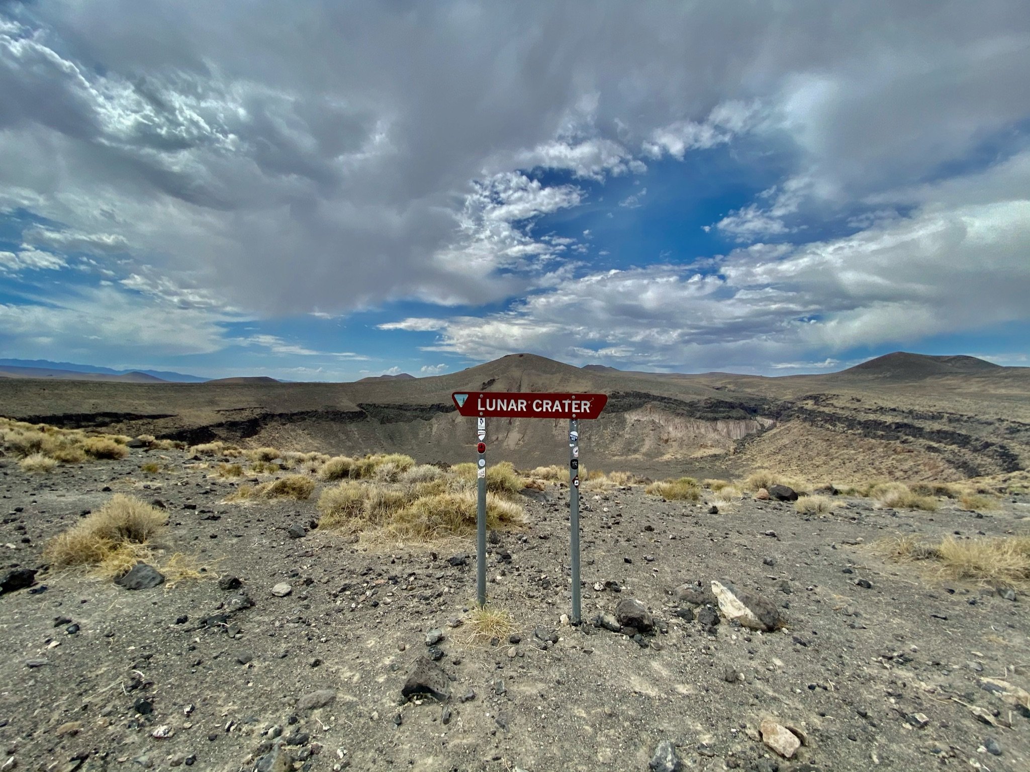
Lunar Crater National Natural Landmark
Tonopah, NV, 89049
Our rating:
*3 out of 5 stars* This is a beautiful view and you will most likely have it all to yourself but it is definitely off the beaten path. We really enjoyed just taking in the complete silence and the interesting landmark.
About the place:
The Lunar Crater located in a volcanic field is the largest natural crater in all of Nevada, it’s 1 km long and 130 meters deep. This landmark was named because it looks very similar to the craters found on the moon but it actually was created by shallow explosions thousands of years ago
How to get there:
Lunar Crater is located on an unmarked dirt road off of Grand Army of the Republic Hwy about 80 miles east of Tonopah, NV.
Places Near by:
Black Rock Lava Flow 16.3 miles away (28 mins)
Clark County
Valley of Fire State Park
Moapa Valley, NV 89040
Beehives
Valley of Fire Hwy, Overton, NV 89040
Our rating:
*5 out of 5 stars* The Beehives at Valley of Fire State Park are the perfect stop for everyone. We had a ton of fun exploring this area and seeing the fascinating rock formations.
About the place:
After visiting you will definitely understand why these are called the Beehives, the rock formations caused by wind & sand erosion look just like them. This is an awesome stop that is just feet from the parking lot. There isn’t a marked trail here but you can adventure around the area and take in the beautiful scenery.
The parking lot for this location is located off of Valley of Fire Hwy, just 2.8 miles away from the Visitor Center.
How to get there:
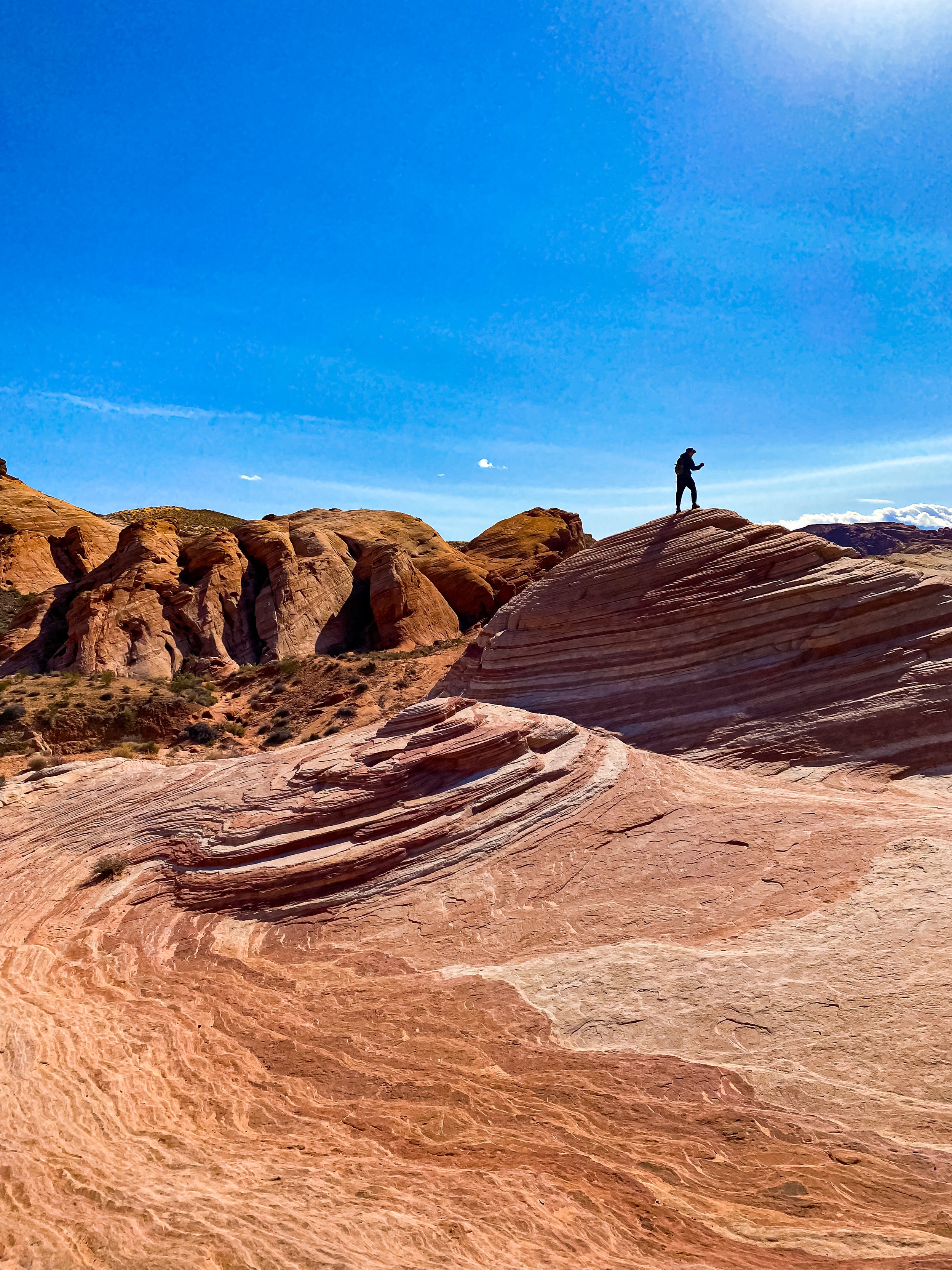
Fire Wave Trail
Mouse’s Tank Rd. Overton, NV 89040
Our rating:
*5 out of 5 stars* This is known as the most popular trail at this state park so it certainly draws in the crowds. The different rock formations are truly fascinating, if you have the chance to visit wouldn’t miss it!
About the place:
The Fire Wave Trail is a fairly easy 1.5 mile out-and-back trail, or you can make it a loop by hiking the 1.8 mile Seven Wonders Loop. This is the most popular stop at Valley of Fire and the parking area isn’t very large, so it’s best to get here early. It’s important to bring lots of water & wear sunscreen on this hike no matter the season, this area is known to get extremely hot. The interesting striations on the red rocks here is what really bring in the crowds, it’s fascinating what mother nature can create.
This is an easy trail to find, just look for the crowd! The parking lot for this is located off of Mouse’s Take Road about 5 miles from the Visitor Center.
How to get there:
Mouse’s Tank Scenic Drive
Mouse’s Tank Rd. Overton, NV 89040
Our rating:
*5 out of 5 stars* This is perfect for anyone to do while visiting Valley of Fire! The views are incredible and there’s no hiking need unless you want to make stops along your way!
About the place:
Mouse’s Tank Scenic Drive is 5.7 miles long road that twist & turns through the beautiful Valley of Fire. There are tons of stops you can do along this road or you can just take in the views from the comfort of your car!
How to get there:
Mouse’s Tank Road is located off of the main Hwy through Valley of fire. This is the same road the the Visitor Center is located on. This road is also referred to as the White Domes Road.
Seven Sisters
CFGX+CG, Moapa Valley, NV 89040
Our rating:
*3 out of 5 stars* This quick little stop that’s a perfect place for a lunch break with beautiful views.
About the place:
The Seven Sisters viewing area is a great stop to enjoy a picnic at one of the tables there with 7 stunning rock structures around you. There are also restrooms here which make it even more convenient.
How to get there:
The Seven Sisters are located just 2 minutes from the Visitor Center. You can park in the parking lot off of Valley of Fire Hwy.
29450 Fire Cove Rd, Overton, NV 89040
White Domes Loop
Our rating:
*5 out of 5 stars* I recommend this hike more than any here! White Domes Loop was definitely our favorite one at this park.
About the place:
The White Domes Loop is the perfect stop! This trail is only 1.25 miles round trip and offers a little bit of everything that Valley of Fire has to offer. We had so much fun on this hike, out of the few we did this was definitely our favorite.
How to get there:
The parking lot for the White Domes trail is located at the very end of Mouse’s Tank Road. This trail is about 15 minutes from the Visitor Center.
Other stops in Valley of Fire:
Arch Rock
Atlatl Rock
Elephant Rock
Rainbow Vista Overlook Trail
Places near by:
Las Vegas 46.2 miles away (50 mins)
Hoover Dam 62.9 miles away (1 hour 15 mins)
Zion National Park 121 miles away ( 2 hrs)


